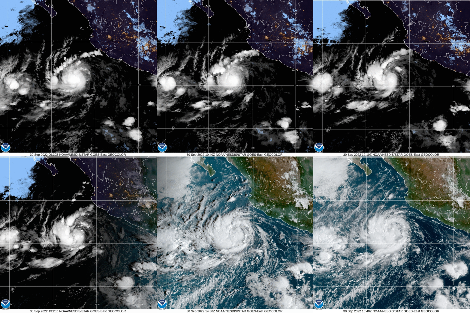
( Spanish) —tropical storm Orlenewhich is located on the Pacific Ocean 440 km southeast of Manzanillo, in Colima, is moving northwest at a speed of 7 km/h, according to the update of the National Water Commission on Friday at 10:00 am, Central Mexico time.
Orlene has maximum sustained winds of 95 km/h and gusts of up to 110 km/h. This Friday, the cloud bands reinforce the conditions for very heavy rains to be recorded in Colima, Jalisco, Michoacán and Nayarit, which could reach 50 to 75 mm. Wind gusts of 40 to 50 km/h could also be recorded in Colima and Jalisco.
(Source: US National Hurricane Center)
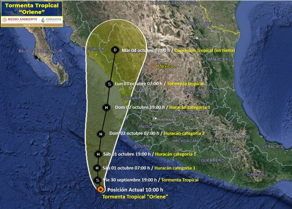
The tropical storm will become a Category 1 hurricane on Saturday while still over the ocean, according to the National Weather Service forecast, and will continue its path to the northwest. By Sunday, October 2 at 07:00 am local time, Orlene would already be a category 2 hurricane and would be located off the coast of the state of Jalisco.

Orlene’s trajectory projected by the National Meteorological Service of Mexico.
Between Monday, October 3, and Tuesday, October 4, it would be on land but as a tropical storm and tropical depression, respectively, that is, with less intensity than it will have while it is in the Pacific Ocean. On land it would affect the states of Nayarit, Sinaloa, Durango and Chihuahua, according to the trajectory projected by the meteorological service.
Its forecast indicates that on Monday at 07:00 am it will be located 35 km south of Mazatlán, in Sinaloa, and will have winds of between 110 and 140 km/h. The next day, already on land, it will be at 07:00 am 200 km east-northeast of Altata, also in Sinaloa, with winds between 45 and 65 km/h.


![[Img #74662]](https://thelatestnews.world/wp-content/uploads/2024/12/Organisms-with-the-shortest-life-150x150.jpg)


