Hurricane Beryl poses a serious threat to Caribbean communities after intensifying at an explosive rate. This is the fastest Category 5 hurricane on record in the Atlantic.
According to World Meteorological Organization (WMO), this record sets an alarming precedent for what is expected to be a very active hurricane season with risks for the entire Atlantic basin, and once again highlights the need for the multi-hazard early warning system.
Beryl is now a Category 5 hurricane on the Saffir-Simpson scale as it heads toward Jamaica. Sustained winds have increased to nearly 270 km/h with higher gusts and extending outward up to 65 km/h, according to the WMO’s Miami Regional Specialized Meteorological Center, operated by the WMO. National Hurricane Center (NHC) from the United States.
This organization warns of Life-threatening winds, storm surges and flooding.
Beryl struck the southern Windward Islands at Category 4 strength on the Saffir-Simpson scale on July 1, with maximum sustained winds near 220 km/h. It made a direct hit on Grenada, the archipelago’s capital, and had significant repercussions on St. Vincent and the Grenadines. These are small islands with little experience in dealing with a Category 4 hurricane.
It is likely to lose strength, but it will still remain dangerous.
Fluctuations in strength are likely over the next day or so, but Beryl is expected to remain an extremely dangerous major hurricane as its core moves into the eastern Caribbean. Some weakening is expected in the central Caribbean by midweek, but Beryl is still forecast to remain a hurricane, according to the NHC.
The U.S. National Hurricane Center warned of potentially catastrophic wind damage from the core of Beryl, which could reach Jamaica as early as Wednesday.
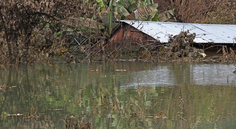
The storm surge will raise water levels by 0.9 to 1.5 metres above normal tide levels in Jamaica, with rainfall totals of 101 to 202 mm and locally 303 mm. This rainfall may cause flash flooding in vulnerable areas. Rainfall from the outer bands of Beryl could affect parts of Hispaniola on Tuesday and into Wednesday.
“It only takes one hurricane to make landfall to set back years of socioeconomic development. For example, Hurricane Maria in 2017 cost Dominica 800% of its Gross Domestic Product,” said the General secretary Deputy World Meteorological Organization Secretary Ko Barrett.
Rapid intensification
The Intergovernmental Panel on Climate Change predicts that the proportion of intense tropical cyclones and the mean and maximum precipitation rates will increase as a result of climate change.
Hurricane Beryl strengthened from a tropical depression to a Category 3 hurricane in 42 hours, and a Category 4 hurricane in 48 hours. This is unprecedented for the month of June, but is consistent with the recent trend of very rapid intensification.as was the case with Hurricane Otis, which became a Category 5 hurricane overnight and hit the Mexican resort of Acapulco last October.
One of the reasons Hurricane Beryl intensified to Category 5 status more than two weeks earlier than any other Atlantic hurricane on record is due to the very high levels of ocean heat content.
According to Philip Klotzbach, part of the WMO’s network of scientific experts, The ocean heat content in the Caribbean is today what is normally recorded in mid-September.
Sea surface temperatures (over 60°S-60°N) have been record high for the corresponding month for 14 months (figures through May 2024).
Traditionally, the central and eastern Atlantic becomes most active in August, in part because ocean temperatures have had time to warm and fuel developing systems. Typically, ocean temperatures are not warm enough in June and July to help tropical systems thrive.
This sets the stage for what is expected to be an especially active and dangerous hurricane season for the entire Atlantic, Caribbean and Central American basins.
Active season
The National Oceanic and Atmospheric Administration’s Climate Prediction Center United States It is expected that between 17 and 25 named storms will occur (the average is 1).4). Of these, 8 to 13 are expected to become hurricanes (average: 7), including 4 to 7 major hurricanes (average: 3).
A major hurricane is a Category 3, 4, or 5 on the Saffir-Simpson scale, with winds of 178 km/h or higher.
The Atlantic hurricane season lasts from June 1 to November 30 and is closely monitored by the World Meteorological Organization’s Tropical Cyclone Program. This is the eighth consecutive year of above-average activity.The last below-normal season was in 2015.
Warm sea surface temperatures and a lack of wind shear due to the transition from El Niño to La Niña season are the Fuel for the development of tropical storms and hurricanes.
Early warnings for all
WMO early warnings and improved disaster risk management have drastically reduced the number of fatalitiesbut the Small Island Developing States of the Caribbean continue to suffer disproportionately.
Rising sea levels, exacerbated by storm surges, increase the potential risk to coastal communities.
For this reason, WMO and its partners have prioritized early warning measures on small islands within the framework of the international initiative Early Warnings for All.


Add Comment