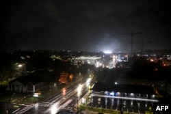
Hurricane Helene weakened to Category 1 on Friday morning with maximum sustained winds of 75 mph (120 kph), according to the National Hurricane Center.
The storm moved north from Florida to Georgia and was about 100 miles (160 kilometers) from Augusta and 40 miles (65 kilometers) from Macon, moving about 30 mph (48 kph), the hurricane center in Miami said. in an update at 4 a.m.
The storm made landfall in northwest Florida as a Category 4 storm as forecasters warned the massive system could create a “nightmare” storm surge and bring dangerous winds and rain to much of the southeastern United States. There were at least three deaths related to the storm.
The hurricane center said Helene made landfall around 11:10 p.m. Thursday near the mouth of the Aucilla River in the Big Bend area of Florida’s Gulf Coast. It had maximum sustained winds estimated at 140 mph (225 kph). That location was just 20 miles (32 kilometers) northwest of where Hurricane Idalia made landfall last year with almost the same ferocity and caused widespread damage.
Helene caused hurricane warnings and flash flooding that extended well beyond the coast into northern Georgia and western North Carolina. More than 1.2 million homes and businesses were without power in Florida, more than 190,000 in Georgia and more than 30,000 in the Carolinas, according to the tracking site poweroutage.us. The governors of those states and Alabama and Virginia declared emergencies.
One person died in Florida when a sign fell on their car and two more were reported dead due to a possible tornado in southern Georgia as the hurricane approached.
“When Floridians wake up tomorrow morning, they are going to wake up in a state where there have most likely been deaths and there are certainly going to be property losses,” Florida Governor Ron DeSantis said at a press conference on Thursday night.
Helene was moving rapidly inland and its center was expected to cross from southern to northern Georgia into early Friday. The risk of tornadoes will persist overnight and into the morning in northern and central Florida, Georgia, South Carolina and southern North Carolina, according to forecasters. In Virginia they could occur later on Friday.
“Helene continues to produce catastrophic winds that are now moving into southern Georgia,” the NHC said in a report at 1 a.m. Friday. “People should not leave their shelters.”
The effects of the meteor were felt before it made landfall, with sustained tropical storm-intensity winds and hurricane gusts on the west coast of Florida. Water washed over a road in the northern part of Cape Siesta, near Sarasota, and covered some intersections in St. Pete Beach. Wood and other remains from a fire that occurred in Cape Cedar a week ago crashed onto the shore.
Helene is the eighth named storm of the Atlantic hurricane season, which began June 1. The National Oceanic and Atmospheric Administration predicted this season will be above average due to record-breaking ocean temperatures.
[Parte de la información para este informe provino de The Associated Press, Reuters y Agence France-Presse]
Connect with the Voice of America! Subscribe to our channels YouTube, WhatsApp and to the newsletter. Turn on notifications and follow us on Facebook, x and instagram.


Add Comment