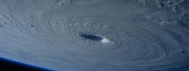
While many eyes were focused on the evolution of the weather situation in the Caribbean, Carlotta has made an appearance on the west coast of North America. This is the third named storm in the waters of the northeastern Pacific.
New storm. Carlotta already has reached tropical storm category as it moves over the Pacific waters. The storm is located, according to the latest data, south-southwest of the Baja California peninsula. The storm is moving in west-northwest directionbut it could be noticed in the state of Baja California Sur.
According to NOAA forecasts (National Oceanic & Atmospheric Administration) and the National Meteorological Service of Mexico (SMN) indicate that the storm could evolve over the next few days before losing strength at the beginning of next week. SMN forecasts They say the storm could even become a Category 2 hurricane on Saturday, the 3rd.
For now, according to NOAA dataCarlotta’s maximum sustained winds are 110 kilometers per hour, although gusts reach higher speeds. Tropical storm-force winds extend outward 130 kilometers (80 miles) from the storm’s center.
Partial impacts. Carlotta is not heading towards the mainland, but its effects may be felt in some areas. The SMN warns For example, there will be showers in Baja California Sur with precipitation between 5 and 25 mm. On the coast, waves of between one and two metres in height are also expected. This is why it is recommended to take extreme caution in these places, also because of the wind.
Carlotta is not alone. Charlotte is accompanied by two disruptions with the potential to become tropical storms or hurricanes in the next few days. Both are located further south. Disruption number 1, located southeast of Carlotta, is the least significant due to its location and low probability of evolution.
Disruption No. 2, on the other hand, located southeast of Carlotta, is closer to land and has a 30% chance of evolving within 48 hours, but a 90% chance of doing so in subsequent days. The system is currently generating rain and storms over Pacific waters. Like Carlotta, this system is moving west-northwest.
And what about Debby? Debby remains just a promise for now. The system that could become the fourth named storm of the Atlantic hurricane season is formed by a disruption zone that is now over western Cuba and Florida, and parts of the eastern Gulf of Mexico.
The probabilities of the system evolving in the next 48 hours are, According to NOAA50%, while the probability of doing so in the following days is 80%.
The agency said that regardless of how the storm develops, heavy rains could be expected, leading to flooding in parts of Florida, Cuba, and the Bahamas. The agency also said that the agency’s Hurricane Hunter aircraft was prepared to monitor these areas if necessary.
At Xataka | There’s a reason why hurricanes don’t reach Europe, but this may start to change
Image | NOAA


Add Comment