Published:
Jun 12, 2024 14:27 GMT
In Cascadia, large earthquakes are believed to occur approximately every 300 to 500 years. The last one occurred in 1700.
A research ship that is part of a project led by Columbia University (USA) performed the first comprehensive study of the many complex structures found beneath the seabed in an area considered one of the world’s major geological hazards.

A very dangerous place
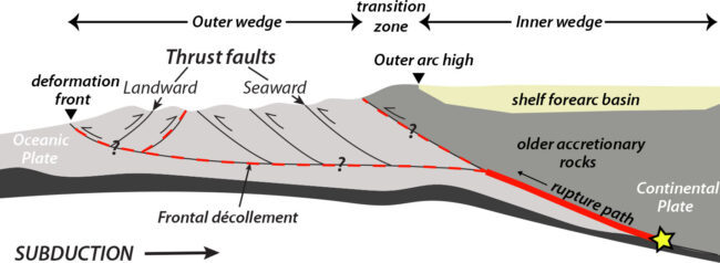
Off the coast of the Pacific Ocean, in North America, There is a strip almost 1,000 km long where the ocean floor it sinks slowly beneath the continent. This place, called the Cascadia subduction zone, is home to a megathrust fault where tectonic plates move against each other in a highly dangerous way. This movement generates enormous tension that is eventually released causing the world’s largest earthquakes.


A failure of this type off Japan caused the Fukushima nuclear disaster in 2011. Similar areas exist off Alaska, Chile and New Zealand, among other places. In CascadiaLarge earthquakes are believed to occur approximately every 300 to 500 years.. The last one occurred in 1700.
The new study
The research vessel Marcus G. Langseth hauled an array of cutting-edge geophysical instruments across nearly the entire area on a 41-day voyage in 2021. The devices on board penetrated the seafloor with powerful sound pulses and read the echoes, which were then converted into images, similar to how doctors create interior scans of the human body. The data collected allowed us to establish the geometry of the descending oceanic plate, the sediments and the composition of the upper North American plate.
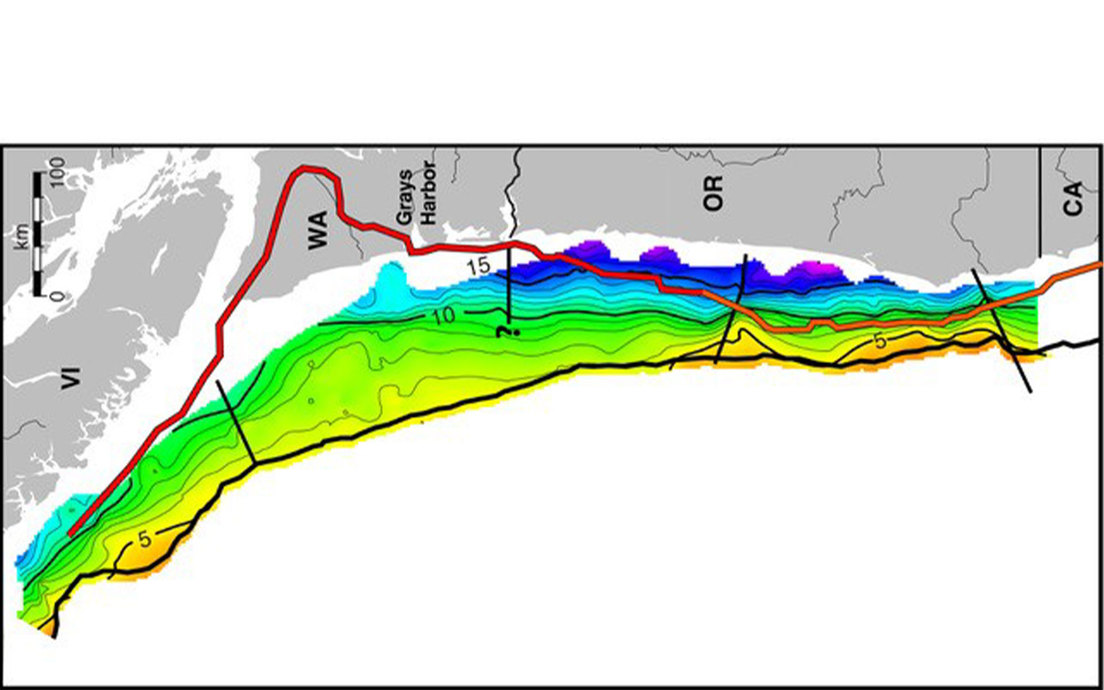
“The models currently used by public agencies are based on a limited set of old, low-quality data from the 1980s,” said Suzanne Carbotte, a marine geophysicist at the Lamont-Doherty Earth Observatory, part of the Climate School of Columbia University. “The megathrust has a much more complex geometry than previously assumed. The study provides a new framework for assessing the hazards of earthquakes and tsunamis,” says the expert.


A key finding
The researchers focused on one particular segment of the megafault, which runs from southern Vancouver Island (in Canada) across Washington state and ends roughly at the border with Oregon (both US territories). .USA). On the other segments of the fault, most of the earthquake-prone plate interface lies offshore, but here the study found that the shallow subduction angle means it could probably magnify any ground tremors.
“It requires a lot more study, but for places like Tacoma and Seattle, it could mean the difference between alarming and catastrophic,” said Harold Tobin, a geophysicist at the University of Washington and co-author of the study. The investigation is public last Friday in Science Advances.
Predict earthquakes?
Researchers emphasize that an earthquake cannot be predicted. What you can really do is forecast probabilities of multiple scenarios, hoping to help authorities design building codes and warning systems to minimize damage when something happens. Understanding the underground structures and mechanics of the Cascadia Subduction Zone would allow delineating the places most susceptible to earthquakeshow big they might be, and what warning signs they might produce.


Add Comment